Union Gap Is Its Own City: Where Yakima Coffee Ends on the South Side


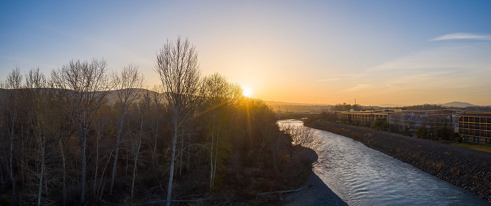
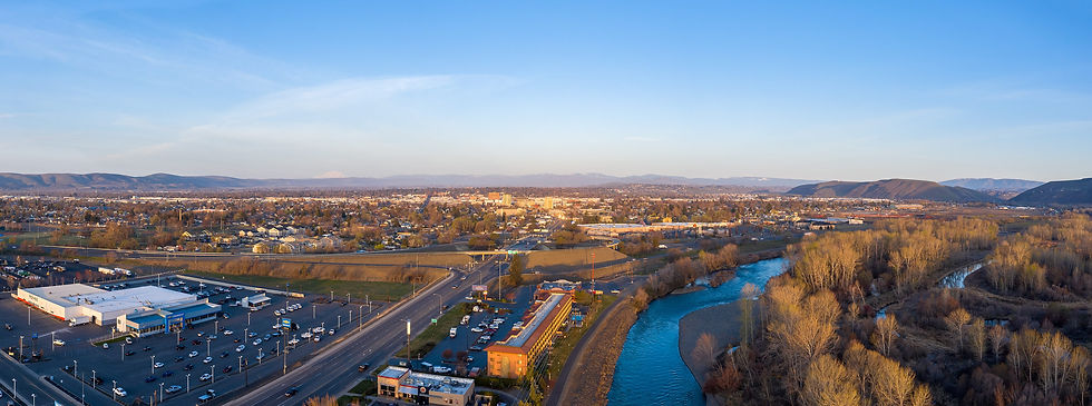
Photo: Chris Light, CC BY-SA 4.0, via Wikimedia Commons
Drive south on 1st Street out of downtown Yakima and the city does not announce that it is ending. The storefronts keep coming, the traffic keeps moving, and somewhere past the Dutch Bros stand at 2105 S 1st St you cross into a different city entirely. That city is Union Gap, and it has its own city hall at 102 West Ahtanum Road, its own Main Street and its own population count.
The numbers make the difference plain. The Census Bureau's American Community Survey 2023 five year estimates put Yakima city at 96,810 people and Union Gap at 6,511. Those two figures are never added together in anything I write about Yakima coffee, because they describe two separate places that happen to share a border, a river and a stretch of road.
This piece walks the south side of the Yakima coffee map and marks where it stops. It covers how Union Gap came to exist as its own city, what sits along its Main Street, how the zip codes overlap, and what that means for a drinker typing coffee near me on the south end of town or for a cafe owner trying to describe its own city correctly.
Two Cities, One Stretch of Road
Yakima is the county seat of Yakima County and the larger of the two cities by a wide margin. Its 96,810 residents in the 2023 ACS estimates make it a city in the full sense, with a downtown grid, a historic district, a West Valley side and several coffee pockets that the rest of this series maps street by street. Union Gap, at 6,511 residents in the same survey, is roughly one fifteenth that size.
Size is not the point, though. Union Gap is incorporated. It has its own council, its own city offices on West Ahtanum Road and its own place in every Census table. When the Census Bureau counts people, a Union Gap household is counted in Union Gap, not in Yakima, even if the family drives into downtown Yakima every morning for work.
The newer 2024 five year profile on Census Reporter prints Union Gap at 6,584 people across 5.6 square miles, about 1,180.6 people per square mile, with a median age of 34.5. That later figure is a different survey window, so I keep it labeled as the 2024 print and keep the 2023 figure of 6,511 as the matched comparison against Yakima's 96,810. Either way, the takeaway is the same. Union Gap is a small city of its own, not a Yakima neighborhood.
For coffee, this means a simple rule. A cafe, stand or kiosk with a Union Gap address belongs to Union Gap's coffee story. It does not raise Yakima's count, and Yakima's shops do not raise Union Gap's. The two cities sit close enough that a phone map treats them as one blur of pins, which is exactly why the line needs saying out loud.
Yakima City Came First
The history runs the opposite way from what most visitors assume. Union Gap is the older town. Settlers who stopped along the Yakima River in 1865 stayed near the gap, and the village took the name Yakima City. HistoryLink, the free online encyclopedia of Washington history, records that George Goodwin platted his homestead under that name in 1872, and the town incorporated in 1883.
Then the railroad arrived. The first Northern Pacific train reached Yakima City on December 24, 1884, but on February 4, 1885 the railroad filed a plat for a new depot town about four miles to the north. That new town was North Yakima. HistoryLink describes more than 100 buildings being put on rollers and dragged by horses to the new site, which is the origin story of downtown Yakima as it stands today.
The names settled more than thirty years later. In 1917 the Washington State Legislature renamed the old Yakima City as Union Gap, and North Yakima became simply Yakima on January 1, 1918. HistoryLink still calls Union Gap the first and oldest town in all of Yakima County.
So the south side of the coffee map ends at the place where the whole valley's town life began. Anyone standing on Union Gap's Main Street is standing in the original Yakima City, and anyone ordering a latte downtown is ordering it in the railroad's replacement town. That history is a good reason to keep the two cities distinct rather than folding one into the other.
The Gap Itself
Union Gap takes its name from the landform. The Yakima River cuts a narrow passage between Ahtanum Ridge and the Rattlesnake Hills, and the city sits in and around that water gap. Interstate 82, U.S. Route 97 and the BNSF Railway all squeeze through the same opening, which is why so much of the valley's traffic passes through Union Gap without stopping.
The city covers about 5.58 square miles at an elevation of roughly 997 feet. Yakima city covers about 28.32 square miles and sits at about 1,207 feet. The Naches River forms Yakima's northern border, and the ridges frame Union Gap's southern edge, so on a map the two cities stack north to south along the river with no open country between them.
That stacking is what makes the city line easy to miss. A driver heading south on 1st Street, or north on Interstate 82 from the lower valley, moves from one city to the other without a change in scenery. The only honest markers are the address on a storefront and the city name printed on a listing.
For a coffee drinker coming up from the lower valley, the gap is often the first place a caffeine stop makes sense. For someone describing where that stop is, the landform is a useful reminder: the gap belongs to Union Gap, and the city it guards on the north side is Yakima.
Where South 1st Street Runs Out
South 1st Street is one of the long spines of Yakima's coffee map. Downtown, at the low numbers, it holds the independent rooms that the rest of this series covers. Farther south the address numbers climb into the two thousands, and the Dutch Bros stand at 2105 S 1st St sits out there, the farthest south of the three Yakima Dutch Bros locations on the chain's own locator.
That stand is a clean example of how address details carry the city line. Dutch Bros prints it as 2105 S 1st St, Yakima, WA 98903. Its posted hours run from 5 a.m. to 10 p.m. Sunday through Thursday and from 5 a.m. to 11 p.m. on Friday and Saturday. It is a Yakima stand, counted in Yakima's three, and it gives the south side a late evening drive thru option long after downtown shops have closed for the day.
A little farther south, the same named street shows up in Union Gap's own listings. Visit Yakima, the valley's tourism bureau, lists a restaurant at 2415 South 1st Street among its Union Gap dining picks. The street keeps its name, but the city on the address changes somewhere in that stretch, and a searcher has no way to see the line from the road.
The zip code does not settle it either. Union Gap's city offices use 98903, and so does the Yakima Dutch Bros stand at 2105 S 1st St. Downtown Yakima addresses on North and South 1st Street use 98901, and West Valley addresses use 98908. A shared zip is a postal route, not a city boundary, so the city name on the address is the part that counts.
Main Street, the Mall and the Museum
Union Gap has its own center of gravity, and it is not South 1st Street. Its Main Street carries the city's retail and civic life. Visit Yakima lists Valley Mall at 2529 Main Street and describes it as home to 80 local, regional and national retailers. HistoryLink calls the mall the Yakima Valley's largest mix of shops and services.
The same street holds the Central Washington Agricultural Museum at 4508 Main Street, in Fulbright Park. The museum describes itself as home to more than 150 antique tractors and over 1,000 pieces of historic machinery, and it was founded as a nonprofit on March 15, 1979. Visit Yakima lists the Olde Yakima Letterpress Museum at the same address.
Union Gap also keeps its own calendar. Old Town Days and the Central Washington Antique Farm Exposition mark the valley's farming history each August, and Visit Yakima describes the Father's Day weekend Civil War reenactment in Union Gap as the biggest such event in Washington State.
All of that matters for coffee because it is where people actually spend time in Union Gap. A shopper at the mall, a family at the museum or a crowd at a reenactment weekend is a Union Gap customer. When a coffee stop serves them, it serves them in Union Gap, and describing it as part of downtown Yakima would send people to the wrong part of the valley.
Why the Two Counts Stay Apart
Every Yakima post Hillcane writes keeps a geography lock. Yakima is not Tri Cities, it is not Walla Walla, and it is not Union Gap. The first two are far enough away that most readers already know the difference. Union Gap is close enough that the difference gets lost, which makes it the most important of the three to state.
The mistake usually happens by addition. A roundup of coffee shops in Yakima pulls in every pin that appears on a map centered on the city, and some of those pins sit in Union Gap. Then a population line gets written as if the two cities were one, and a city of 96,810 quietly becomes a bigger number that no Census table actually prints.
Keeping the counts apart is fairer to both cities. Union Gap's coffee stops deserve to be described as part of a real city with a real history, not as an overflow lot for Yakima. Yakima's own shops deserve a count that reflects what is inside its own limits. Neither one gains anything from being blended.
It also makes a map more useful. A visitor who knows that the south side of Yakima runs into Union Gap can read an address and understand where they are headed, whether that is a drive thru on South 1st Street or a stop near the mall on Main Street.
What a Coffee Search Sees on the South Side
A phone search for coffee near me does not know about city lines. It draws a circle around the searcher and fills it with pins. Standing on South 1st Street, that circle easily reaches into Union Gap, and the results can mix Yakima and Union Gap businesses in a single list without labeling which city each one is in.
Hillcane's Yakima posts have already shown that the same search can change shape depending on where it is run and how it is worded. A search from downtown leans toward the 1st Street and Front Street shops. A search from the south end leans toward whatever sits closest to the gap. Neither result is wrong, but neither result is a census of Yakima coffee either.
For a drinker, the practical fix is simple. Read the city name on the address before driving. A pin that says Union Gap is in Union Gap, a pin that says Yakima is in Yakima, and both can be a good cup. The distance between them is often a few minutes, but the difference matters when someone is giving directions or planning a stop around a museum visit or a shopping trip.
For a cafe owner on either side of the line, the lesson is to print the correct city everywhere. A Union Gap cafe that lists itself as Yakima, or a Yakima stand that drifts into a Union Gap label, invites exactly the kind of confusion that makes AI answers hedge and map users double back.
Reading the Map Before You Drive
The south side of Yakima coffee is short and clear once the line is visible. Downtown South 1st Street holds the independent shops near the city core. The Dutch Bros stand at 2105 S 1st St, open from 5 a.m., is Yakima's southern drive thru. Past that, the street runs toward Union Gap, where Main Street, Valley Mall and the agricultural museum anchor a separate city with its own coffee stops.
That is the whole shape of it. Three numbers do most of the work: 96,810 for Yakima, 6,511 for Union Gap, and the address on the door. Keep the first two apart, read the third before turning the key, and the south side of the valley makes sense.
The rest of this Yakima series fills in the other directions: North 1st Street, the historic depot on Front Street, West Valley along Summitview Avenue and Chestnut Avenue near the core. Union Gap closes the map on the south. It is where Yakima coffee ends, and where a different, older city's coffee story begins.
Related Reading
More from this Hillcane city series, plus the pages on the site that sit next to the work.
Dutch Bros Holds Three Yakima Drive Thrus. This Is Not Tri Cities.
One Cafe, Three Addresses: Why Listings Should Agree on Your Street
Yakima Coffee Is N 1st, S 1st, Front Street, and Summitview, Not One Valley Homepage
Front Street and the Historic Depot: Yakima's Railroad Coffee Pocket
West Valley and Summitview Avenue: Yakima's Drive Side for Coffee
The State of Specialty Coffee Visibility in North America (2026)
Google Business Profile for Coffee Shops: The Complete 2026 Checklist
Frequently Asked Questions
Is Union Gap part of Yakima?
No. Union Gap is a separate incorporated city with its own city offices at 102 West Ahtanum Road. The 2023 American Community Survey five year estimates count 6,511 people in Union Gap and 96,810 in Yakima city. The two share a border along the Yakima River and a stretch of South 1st Street, but a Union Gap address belongs to Union Gap, and its coffee stops are not part of Yakima's own count.
Why is Union Gap older than Yakima?
Union Gap began as Yakima City, the valley's first town, which incorporated in 1883. The Northern Pacific's first train arrived on December 24, 1884, and the railroad then platted a new depot town about four miles north, called North Yakima. More than 100 buildings were moved there on rollers. The Legislature renamed the old town Union Gap in 1917, and North Yakima became Yakima on January 1, 1918.
Where is the southernmost Dutch Bros in Yakima?
The Dutch Bros stand at 2105 S 1st St, Yakima, WA 98903 is the farthest south of the three Yakima locations on the chain's own locator. The other two are at 305 N 1st St downtown and 6520 W. Nob Hill Rd in West Valley. The South 1st Street stand posts hours of 5 a.m. to 10 p.m. Sunday through Thursday and 5 a.m. to 11 p.m. on Friday and Saturday.
Does the 98903 zip code mean an address is in Yakima?
Not by itself. Union Gap's city offices at 102 West Ahtanum Road use 98903, and so does the Yakima Dutch Bros stand at 2105 S 1st St. Downtown Yakima addresses on 1st Street use 98901, and West Valley addresses use 98908. A zip code follows a postal route rather than a city boundary, so the city name printed on the address is the detail that tells you which city a coffee stop is in.
Can I add Union Gap's population to Yakima's?
No, and nothing in this series does. Yakima city's 96,810 and Union Gap's 6,511 come from the same 2023 ACS survey but describe two separate places. Adding them produces a number no Census table prints. Census Reporter's newer 2024 profile shows Union Gap at 6,584 people across 5.6 square miles, which is still a separate city figure and still never folded into Yakima's total.
What is the gap in Union Gap?
It is a water gap where the Yakima River cuts between Ahtanum Ridge and the Rattlesnake Hills. Interstate 82, U.S. Route 97 and the BNSF Railway all pass through that opening. The city covers about 5.58 square miles at roughly 997 feet of elevation, just south of Yakima, which sits around 1,207 feet and covers about 28.32 square miles.
What is on Union Gap's Main Street?
Main Street is Union Gap's center. Visit Yakima lists Valley Mall at 2529 Main Street with 80 local, regional and national retailers, and the Central Washington Agricultural Museum at 4508 Main Street in Fulbright Park. The museum says it holds more than 150 antique tractors and over 1,000 pieces of historic machinery. A coffee stop near either one is serving Union Gap visitors, not downtown Yakima foot traffic.
Why do coffee searches mix Yakima and Union Gap results?
A phone search for coffee near me draws a circle around the searcher, and from South 1st Street that circle reaches into Union Gap. The results can list businesses from both cities side by side without labeling the city. Reading the address before driving solves it. A pin that reads Union Gap is in Union Gap, and one that reads Yakima is in Yakima, even when they are only minutes apart.
What events bring people to Union Gap?
Union Gap marks the valley's farming history with Old Town Days and the Central Washington Antique Farm Exposition each August, both tied to the agricultural museum on Main Street. Visit Yakima also describes the Father's Day weekend Civil War reenactment in Union Gap as the largest in Washington State. Those weekends bring crowds that a nearby coffee stop serves as Union Gap customers, not as Yakima ones.
How should a south side cafe describe its location?
Print the correct city everywhere, on the website, the Google listing and every social profile. A Union Gap cafe should say Union Gap, even if the zip is 98903 like some Yakima addresses. A Yakima stand on South 1st Street should say Yakima. Consistent city names help map users and AI answers place the business correctly, and they keep the Yakima count of 96,810 residents separate from Union Gap's 6,511.
Work with Hillcane
Drive south on 1st Street and Yakima ends without a sign. Union Gap, the valley's oldest town and a city of 6,511, begins. Here is where the coffee map stops and why the two counts never mix.
If your cafe on either side of the Yakima and Union Gap line needs its city and street printed the same way everywhere, reach Hillcane at hillcane.co/contact or call (256) 384-2449.

Comments